Ejiri-juku 江尻宿
| Tōkaidō (東海道) | Station 18 of 53 · Nihonbashi (Edo) → Kyoto |
|---|---|
| Present-day location | Shimizu-ku, Shizuoka, Japan |
| Prefecture | Shizuoka (Chubu region) |
| Distance from Nihonbashi | About 165 km (by the historical station tables) |
| Next station | Fuchū-shuku — about 10.6 km on |
| Coordinates | 35.02349° N, 138.48704° E |
35°01′25″N 138°29′13″E / 35.023495°N 138.487043°E / 35.023495; 138.487043
Ejiri-juku (江尻宿, Ejiri-juku) was the eighteenth of the fifty-three stations of the Tōkaidō. It is one of four former post stations located in what is now part of the Shimizu-ku area of Shizuoka, Shizuoka Prefecture, Japan. It was 3.4 kilometers from Okitsu-juku, the preceding post station.
History
Ejiri-juku was Ejiri Castle's castle town. The castle was built in 1570, but Ejiri-juku was not officially designated a post station until the early 17th century. At its peak, it had two honjin, three sub-honjin and 50 hatago, among the 1,340 total buildings. Its population was around 6,500. Ejiri-juku gave its name to the area's railway station, until it was renamed Shimizu Station in 1934.
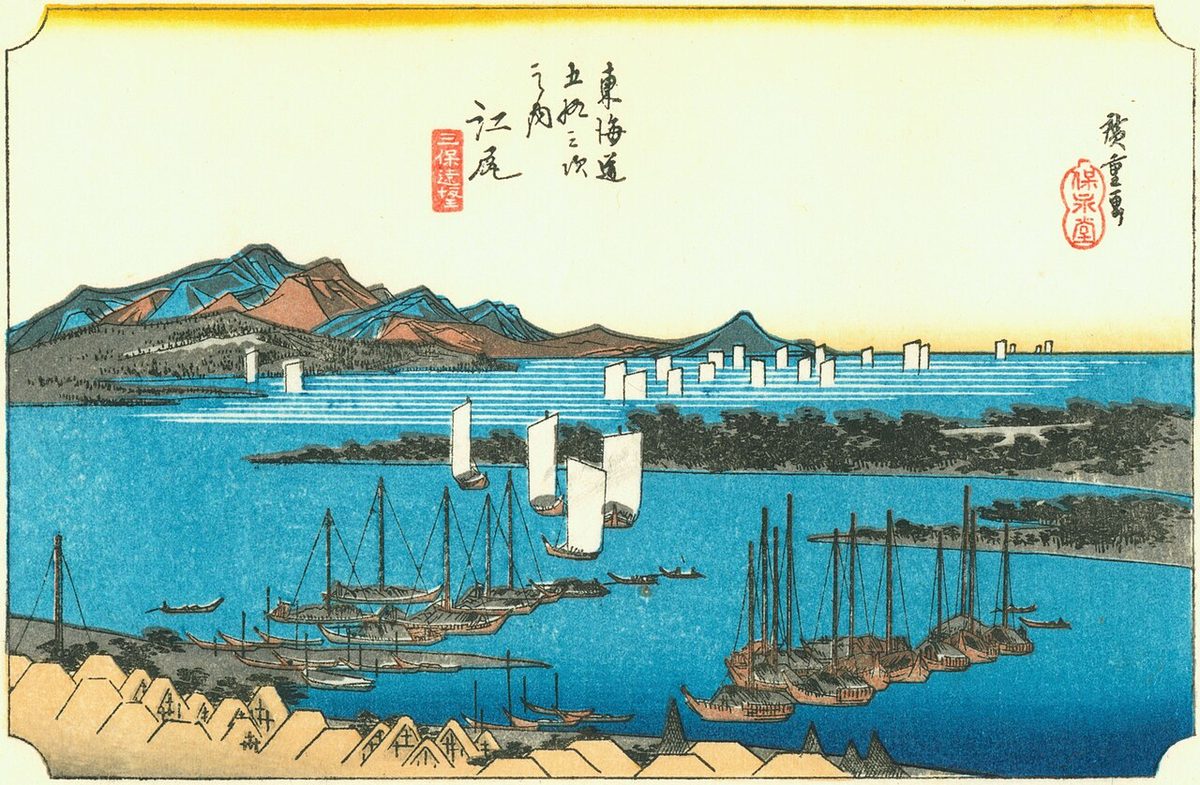
The classic ukiyo-e print by Andō Hiroshige (Hōeidō edition) from 1831–1834 depicts a view over the Miho no Matsubara with boats anchored in the foreground in front of a fishing village, with others sailing in Suruga Bay.
Neighboring post towns
- Tōkaidō
- Okitsu-juku - Ejiri-juku - Fuchū-shuku
Text adapted from the English Wikipedia article Ejiri-juku by its contributors, licensed CC BY-SA 4.0. Station facts cross-checked with the road station lists (Japanese Wikipedia, CC BY-SA 4.0) and Wikidata (CC0).