Home / Tōkaidō / Hamamatsu-juku
Hamamatsu-juku 浜松宿
| Tōkaidō (東海道) | Station 29 of 53 · Nihonbashi (Edo) → Kyoto |
|---|---|
| Present-day location | Hamamatsu, Shizuoka, Japan |
| Prefecture | Shizuoka (Chubu region) |
| Distance from Nihonbashi | About 254 km (by the historical station tables) |
| Next station | Maisaka-juku — about 10.9 km on |
| Coordinates | 34.70602° N, 137.72805° E |
Hamamatsu-juku (浜松宿, Hamamatsu-juku) was the twenty-ninth of the fifty-three stations (shukuba) of the Tōkaidō. It is located in what is now Hamamatsu's Chūō-ku in Shizuoka Prefecture, Japan.
History
During the Tenpō era (1830–1844), Hamamatsu-juku was located in Hamamatsu Castle's castle town. At the time, there were six honjin and 94 hatago for travelers to use, making it the largest post station in Tōtōmi and Suruga provinces. At the time, it was located on the right bank of the Tenryū River, but, over time, the river's course changed, so the post station is now approximately six kilometers from the river's edge.
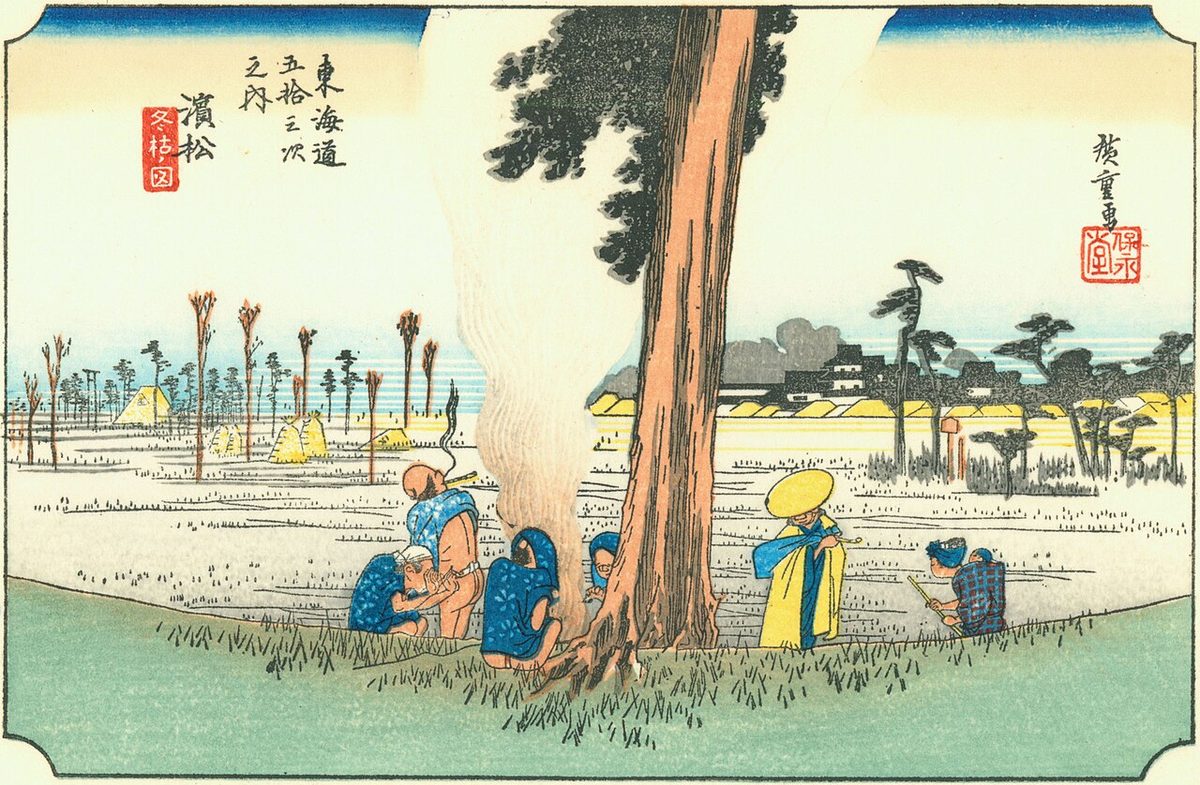
The classic ukiyo-e print by Andō Hiroshige (Hōeidō edition) from 1831–1834 depicts a rural scene with Hamamatsu Castle and the town in the far distance. A group of peasants are warming themselves by a bonfire, with a traveler looking on.
Neighboring post towns
- Tōkaidō
- Mitsuke-juku - Hamamatsu-juku - Maisaka-juku
Text adapted from the English Wikipedia article Hamamatsu-juku by its contributors, licensed CC BY-SA 4.0. Station facts cross-checked with the road station lists (Japanese Wikipedia, CC BY-SA 4.0) and Wikidata (CC0).